
Itbayat, Batanes
Note: This narrative is from Ms. Celerina M. Navarro. She posted it on her Facebook page and I asked for permission to re-post it here. She narrated this as if you are travelling with her as your tour guide and teacher in Batanes.
Welcome to the last inhabited island municipality in the northernmost frontier of the Philippines and to one of the biggest coral uplifts in the world.
I hope you enjoyed your three hour falowa motor boat experience in an open sea.
I’d like to congratulate you for reaching our island! Many tourists do not come this far because of the distance and the intimidating sea travel not to mention the possibility of getting stranded. Here in Batanes, the weather is king and it dictates our travel schedules and many other aspects of our island life. For sure, Itbayat is not a place to go for the less daring and adventurous so you are now among the few who braved the seas and conquered their fears.
The island of Itbayat was formed by these two neighboring volcanoes we now call Ripused on the south and Karoobuban on the north. As you can see, they are the highest points in this undulating plateau of an island. As the volcanoes under the sea spewed out their hot lava, this solidified due to the cold water . The continuous volcanic eruptions made the solidified lava rise higher and higher and soon corals and organism started to grow around them until they got connected. Over thousands of years, their connection became stronger and thicker until by a final uplift Itbayat was born as an island around 1 to 2 million years ago or in the Quatenary Period. This is the reason why even in the middle of the island, one can see many fossilized seashells and coral stones. All around the island and even in the middle of the island we see many limestone rocks, sinkholes, sand deposits and caves which are characteristics of volcanic origin and coral uplift island formations. .
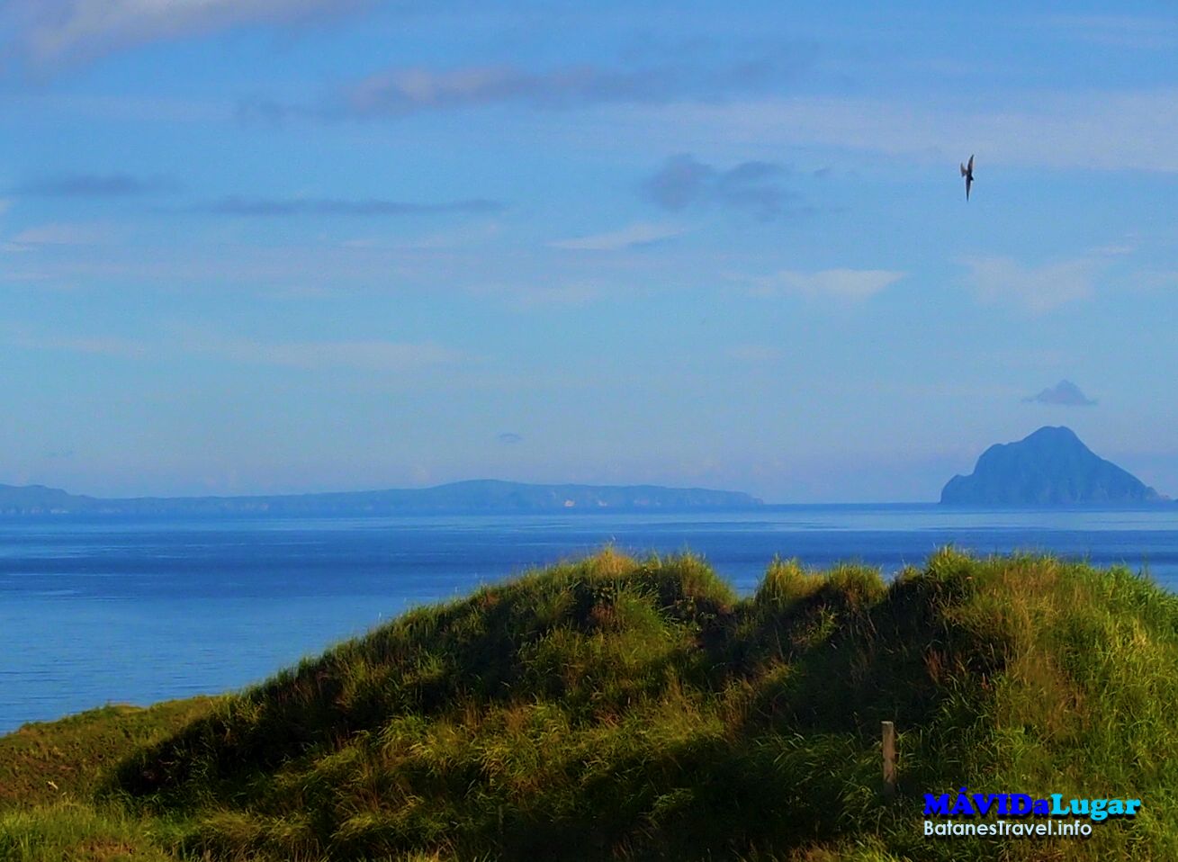
Itbayat is composed of 7 islands namely from the south upward o the north, we have Dinem, Itbayat, where you are now standing, Siayan, Ali, Ditarem, Misanga and the last island in the Philippines and Batanes, Mavulis. Together they have a combined area of 9,011.08 hectares. The smallest and youngest is A’li island with only 8.96 hectares land area.
Itbayat has the biggest land area of all the towns in Batanes, and is second in terms of population to Basco with its population 2,867. There should be more but many are working or have migrated to Basco and Metro Manila and all over the world.
In 2004, Itbayat got its Certificate of Ancestral Domain or CADT issued by the National Commission on Indigenous Peoples or NCIP. It is the only municipality in Batanes that has a CADT so far. This means security of tenure of the Itbayateños in their domain and that these lands cannot be sold to non-Ichbayatans or Ivatans among other conditions as provided in the IPRALaw.
If you are staying for just two or three days, we will not be able to visit all the archaeological sites such as the Ijangs, burial mounds and settlement sites. And by the way, Itbayat is the only place in Batanes where you will definitely need a local tourist guide to bring you around because of the complicated routes one has to take. Unless of course if you plan to just move around in the town proper which is composed of four barangays: Hiñatu on the northwestern side, Marapuy on the northeastern side, Kauxawxasan on the southern side and Kayhijangan on the western side. Itbayat has a fifth barangay called Raele which is 9 kilometers from here.
Notice that almost all of the houses are built on the narrow plain ledges above and on the slopes that end up in the plain at the center where you find all the important buildings of the town: the Catholic Church, Itbayat Elementary School, the hospital, the Municipal Hall and Police station and a few private houses. On our right up the hill called Pudalan is the Itbayat National Agricultural High School. It opened its first and second year classes in 1964 but completed its third and fourth year classes only in 1968.
With such terrain, Itbayat is lucky to have a natural drainage we call Manuyuk, a big sinkhole that ends up to the sea. All the flood waters of this town center go there which prevents flooding during the rainy season. There are a number of sinkholes in this island.
We will now proceed to Karoobooban, the highest point in Itbayat island at 277 m above sea level. We will be going up a view deck where you can see almost all the islands of Itbayat. Close by is a statue of the Blessed Mother Mary. Itbayat sailors who work in international ships that pass through Itbayat requested that it be built high enough for them to see when they pass by. On a good weather some say they can see it which gives them much joy. This is a testimony of the religiosity of the people.
There are many Itbayat families with a member aboard a local, national and specially international ships. A number have served and are still serving as captains or chief engineers and other responsible positions in international ocean-going ships. In fact, Ivatans tend to be adventurers which make them get jobs of this nature.
Here in Itbayat, we have own unique language. Although there are similarities to the ones spoken in Batan which are Ivatan and Isamurungen, there are many words that are different. Even our intonation is different which is more musical than the two spoken in Batan and Sabtang.
As you may have seen, Itbayat has no sandy beach but is fringed by cliffs all around rising from 30 to 100 meters that sink straight into the deep sea. Landing in Itbayat is a big ordeal except in the summer days when getting down from the falowa is very easy. Otherwise it can be nerve -wracking and scary. But no one has died from such causes as falling into the sea during getting off or on the faalowa, All one needs is timing and strong knees and sturdy hands to hold on to the capable hands of the sailors and people in charge of the passengers.
There are six landing areas in Itbayat: Paganaman, Chinapuliran, Valanga, Panembatan all on the western side of the island and Mauyen on the southern end and Axtak on the eastern side. The most accessible are the three on the western side followed by Mauyen and Axtak is only used during emergencies and when the westerlies bring in the rough sea in that western portion of Itbayat.
Itbayat is significant in the Austronesian migration because it is the first land that these intrepid indigenous people reached after their migration from Taiwan 2000 B.C. The landing place is believed to be Turungan, which has a cave that is close to the sea and where people can land with great caution, just like any landing place here in Itbayat.
Itbayat has many archeological sites that have barely been studied. Only Turungan and Anaru have been studied seriously by Dr. Peter Bellwood and his international team
The last place to be reached by the Spanish missionaries was Itbayat. The first to reach itbayat was Fr. Francisco de Paula Esteban in 1799 or 113 years after the first missionaries came to Batanes in 1668 and 16 years after the formal annexation of Batanes to the Spanish government in 1783. He found the people living in settlements deep in the forests and far away from each other. Following the guidelines that had been established in order to facilitate the instruction of the natives, Fr. De Paula Esteban put together the original hamlets in four towns. The best places in the island were chosen which is this place. They became the towns of Sta. Rosa de Calububan, Santa Lucia de Kauhauhasan, Sta. Maria de Marapuyo and San Rafael de Iyuan. They still maintained the same patron name saints with a little modernization of the place names but instead of being 4 towns they are now barangays of this lone town of Itbayat.
This town was founded in 1853 by Fr, Vicente Araujo, At that time there were only 45 private houses all made of wood in this centro. We are now in front of the municipal hall. On its left side is the police station. Notice that the municipal building overlooks the town plaza.. On our left is the Catholic Church and convent originally built 1855, by Fr. Araujo. But it was his successors, Fathers Crecencio Polo and Manuel Blasco who undertook the building of a new church of masonry. In 1888, the church was blessed by Fr. Blasco. He also built the new convent and the courthouse which is now the municipal building. It was later renovated to its present look of a more modern facade, by Rev. Fr. Domingo Deniz, O.P., a Spanish Dominican missionary who served as our parish priest for 46 years starting in 1967 until 2013. He was the last Spanish Dominican who left Batanes after the Batanes church ministry was turned over to the Diocesan priests with the installation of Bishop Camilo Gregorio in 2003.
We will now take a quick visit to Raele, the farthest barangay of Itbayat and to the airport. Raele is 9 kilometers from town and before transportation became available people walk to town by walking or riding on horses. Notice that except for Karobooban and Ripused, Itbayat is one undulating plateau.
The owner of the airline that flies the Tuguegarao Basco route attempted to extend his airlines’ service to Itbayat but found the landing very difficult. He said the lack of any hill around the airport makes the small planes subject to winds blowing from all directions that requires a lot of skill, precision and nerve for a safe landing.
All along our way, you will find the Vuyavuy tree of the date palm family. This variety is endemic to Batanes and this is what we weave into the suhut or women headgear and for men’s jacket as you have seen in Batan and Sabtang. We also make them into brooms and the ripe fruits are very sweet like their bigger varieties. There are many endemic trees here in Itbayat which have since been brought to Batan and even to the mainland of Luzon like the Arius.
Tomorrow we shall wake-up early to go to Rapang and proceed to Turungan. Both are old settlements and each have their own story to tell. Rapang was one of the old settlement in prehistoric times and has an interesting stone bell which when struck can sound like a beautiful brash bell. It is said to have been used by the early settlers to call the people for a meeting and other important events. It is a very scenic place and we will try to reach it by sunrise for you to see the beauty of the sunrise here in Itbayat.
On the other hand, Turungan is a cave that opens out to the sea. Below are rocks that brave fishermen and sailors can embark and depart. This could be the reason why the Austronesians found it suitable for landing after many days of difficult travel from their place of origin in Taiwan. They built a settlement above the cave but used it as a shelter during typhoons and strong windy days. They had a burial site close to this settlement.
There are many archaeological sites here in Itbayat such as old settlements, boat-shaped burial mounds, caves, and other interesting places. Many have not been given full research studies due to limitations of fund and experts. An anthropology expert, Dr. Richard Engelhardt of UNESCO for Culture and Arts for Asia and the Pacific had wanted to recommend Itbayat in the World Heritage List as a geological and archaeological center, a proof of its rich natural and cultural heritage.
We will not be able to visit many of them unless you decide to extend your stay here for at least a month.
So next time prepare for a longer visit. Then we can explore the many exciting nooks and cranny of Itbayat and its satellite islands to our heart’s content.
Author: Celerina M. Navarro
References:
Blending of Cultures: The Batanes 1686-1898, Macapagal- Llorente;
The Batanes Islands, Fr. Julio Gonzales: Emails of Dr. Peter Bellwood and Dr. Richard Engelhardt: The Geology of Itbayat, Ocampo, Robert et al; Geology if Mt Iraya, Maryannick et al; Personal interviews